Garmin Navionics+™ and Garmin Navionics Vision+™ cartography provides superior coverage, clarity and detail with integrated Garmin and Navionics® coastal and inland content, including Auto Guidance+™ technology1. Check chartplotter compatibility.
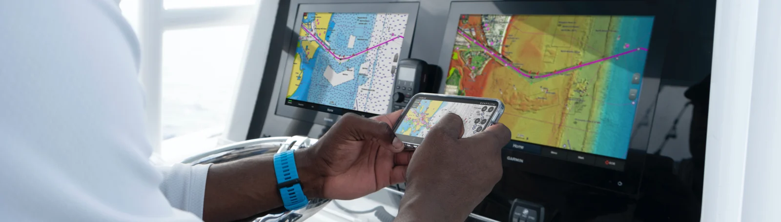
Access detail-rich mapping of coastal features, lakes, rivers and more. Integrated Garmin and Navionics content offers coverage for boaters worldwide.
Shop nowNOTE: If you don’t own a compatible chartplotter and are not planning to upgrade, you can still purchase our previous-generation charts (BlueChart®)
| Garmin Navionics+ | Garmin Navionics Vision+ | |
|---|---|---|
| COASTAL CONTENT | ✓ | ✓ |
| INLAND CONTENT | 42,000 lakes | 42,000 lakes |
| DETAILED NAUTICAL CHARTS | ✓ | ✓ |
| UP TO 0.5 M CONTOURS | ✓ | ✓ |
| DAILY UPDATES 2 | ✓ via ActiveCaptain app | ✓ via ActiveCaptain app |
| AUTO GUIDANCE+ TECHNOLOGY1 | ✓ | ✓ |
| ACTIVECAPTAIN® APP SUPPORT | ✓ | ✓ |
| ACTIVECAPTAIN COMMUNITY | ✓ | ✓ |
| DEPTH RANGE SHADING | ✓ | ✓ |
| SHALLOW WATER SHADING | ✓ | ✓ |
| RELIEF SHADING 2 | ✓via ActiveCaptain app | |
| HIGH-RESOLUTION SATELLITE IMAGERY 2 | ✓via ActiveCaptain app | |
| AERIAL PHOTOGRAPHY | ✓ | |
| 3D FISHEYE VIEW | ✓ | |
| 3D MARINEREYE VIEW | ✓ |
Discover the features and level of detail available with your marine charts and maps.
12 Results found
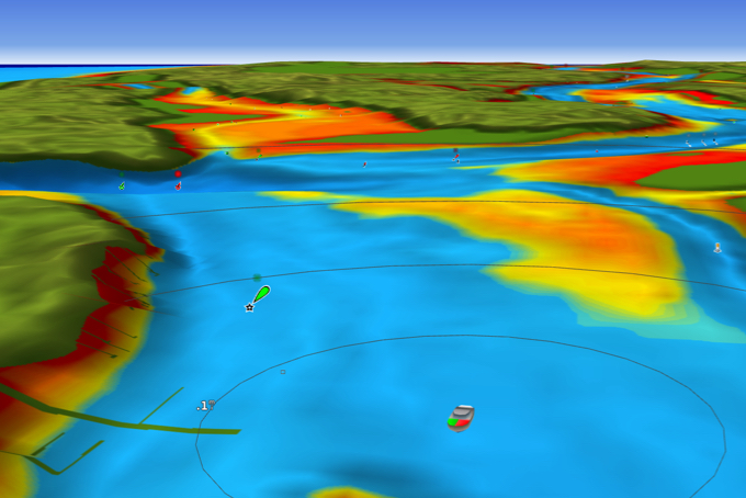
This view provides a 3D representation of the surrounding area both above and below the waterline.
Included in Garmin Navionics Vision+ cartography
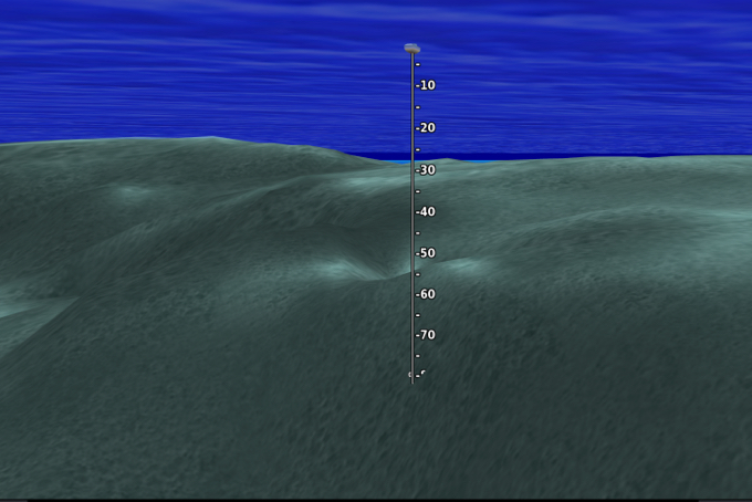
This underwater perspective shows 3D representation of bottom and contours as seen from below the waterline. Interface with sonar data for a customised view.
Included in Garmin Navionics Vision+ cartography
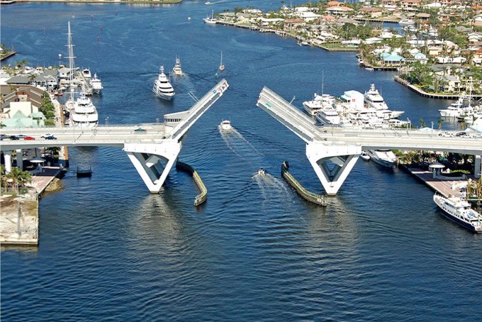
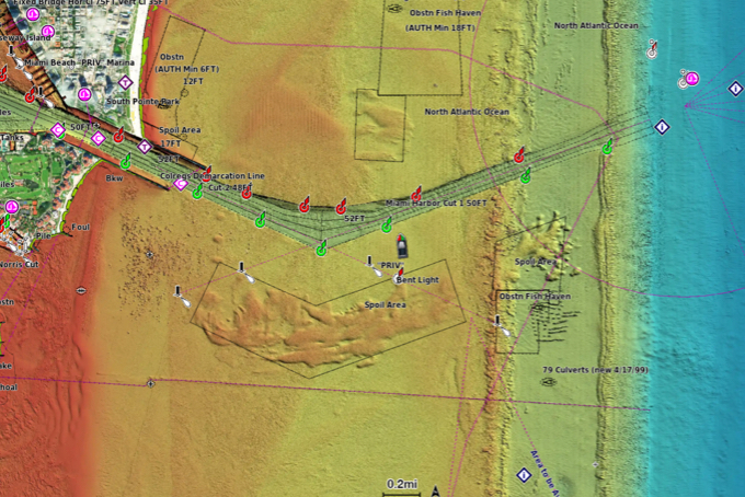
Crystal-clear aerial imagery of ports, bridges, docks, navigational landmarks and more provides a better sense of your surroundings above the waterline.
Included in Garmin Navionics Vision+ cartography
High-resolution satellite imagery provides superior situational awareness.
One-year subscription included in Garmin Navionics Vision+ cartography; requires download from the ActiveCaptain app
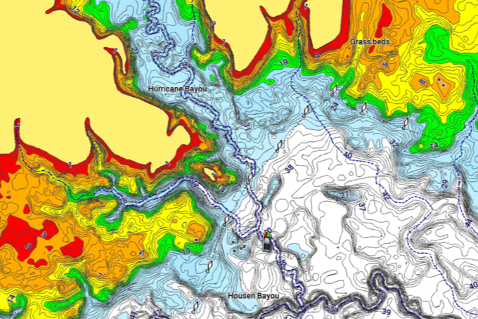
Highly detailed shading combines colour and shadow to provide an easy-to-interpret, clearer view of bottom structure than contour lines alone.
One-year subscription included in Garmin Navionics Vision+ cartography; requires download from the ActiveCaptain app
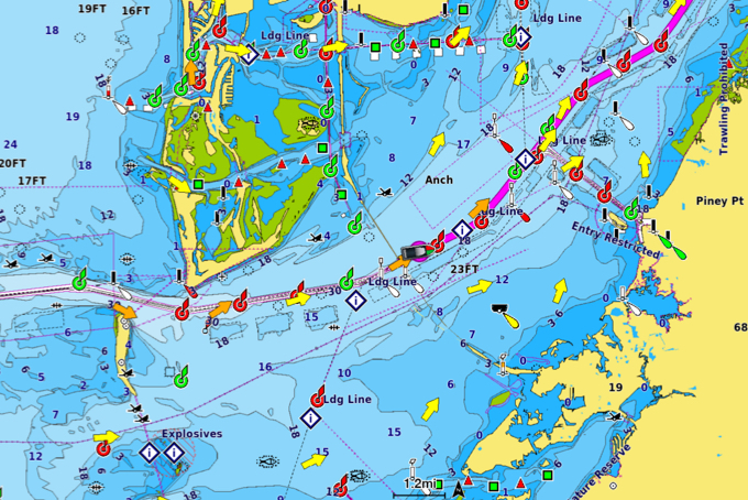
To give a clear picture of shallow waters to avoid, this feature allows for shading at a user-defined depth.
Included in Garmin Navionics+ and Garmin Navionics Vision+
High-resolution depth range shading lets you select up to 10 colour shade options and view your target depths at a glance.
Included in Garmin Navionics+ and Garmin Navionics Vision+
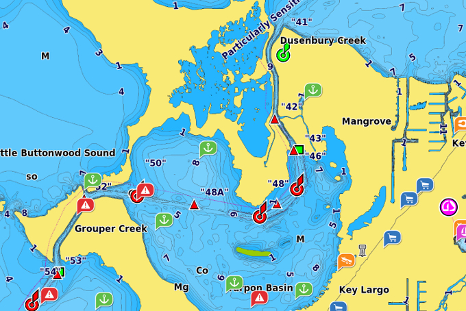
Community-sourced content provides useful POIs, such as marinas, anchorages, hazards, businesses and more. Get recommendations from boaters with firsthand experience of the local environment.
Included in Garmin Navionics+ and Garmin Navionics Vision+
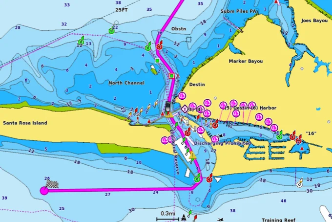
Combining the best of Garmin and Navionics automatic routing features, Auto Guidance+ technology1 gives you a suggested dock-to-dock path to follow through channels, inlets, marina entrances and more.
Included in Garmin Navionics+ and Garmin Navionics Vision+
Easy access to daily chart updates is available via the ActiveCaptain app for the freshest chart data every time out.
One-year subscription included in Garmin Navionics+ and Garmin Navionics Vision+
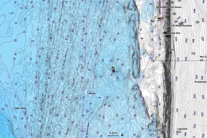
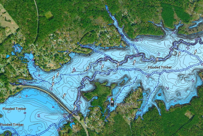
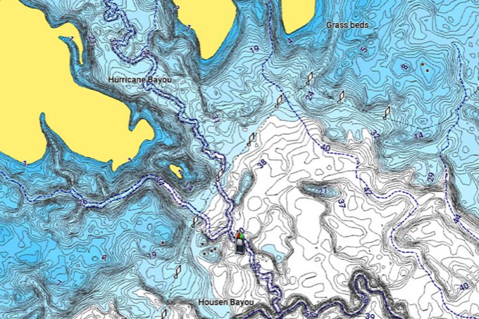
Up to 0.5 m contours provide a detailed and clear view of bottom structure for improved fishing charts and enhanced detail in swamps, canals and port plans.
Included in Garmin Navionics+ and Garmin Navionics Vision+
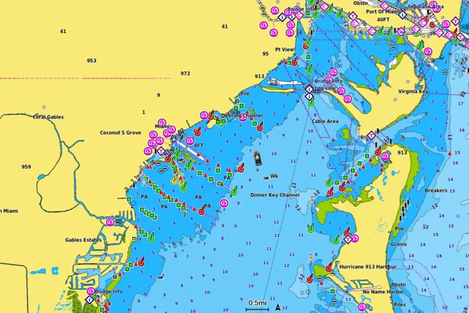
Navigate with our best offshore and inland lake coverage for your Garmin chartplotter with detail-rich mapping, an updated colour palette and integrated Garmin and Navionics content.
Included in Garmin Navionics+ and Garmin Navionics Vision+
Garmin cartography with Navionics data is improved daily. Update your coastal charts and lake maps so you head out with the latest data on your boat.
Update nowNOTE: If you don’t own a compatible chartplotter and are not planning to upgrade, you can still purchase our previous-generation charts (BlueChart®).
Our previous-generation BlueChart g3 and LakeVü g3 mapping products with integrated Garmin and Navionics content are still available for Garmin chartplotters that are not compatible with the newer Garmin Navionics+ chart format.
1Auto Guidance+ is for planning purposes only and does not replace safe navigation operations
2NOTE: Subscription feature; When you purchase a new Garmin Navionics+ or Garmin Navionics Vision+ cartography product, a one-year subscription is included. The subscription includes access to daily chart updates and download of additional content such as raster cartography and premium features (high-resolution relief shading, high-resolution satellite imagery and sonar imagery) where available. Charts and features downloaded during the subscription period remain on the card, but no additional content can be downloaded after the subscription expires.
For preprogrammed charts bought in-store or online, the subscription needs to be activated. When the one-year subscription term expires, you can renew your subscription to continue accessing daily updates and premium features.